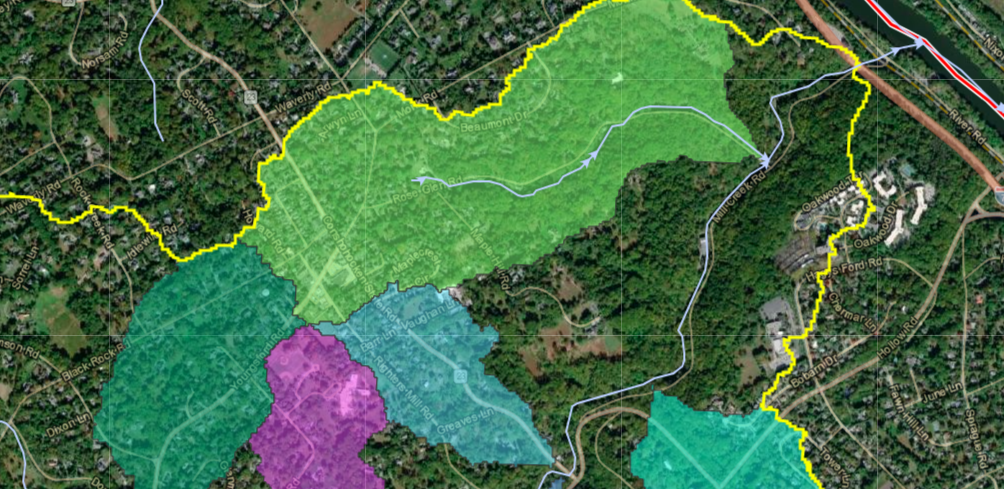
There are plenty of reasons to learn about local streams, whether you are looking for new places to hike, wondering how so much stormwater passes through, or simply interested in perusing our local topography. We created the maps below to illustrate our water’s journey and to facilitate exploration.
The Watersheds Story Map is a comprehensive map of local streams, breaking down watersheds as small as possible using LiDAR data. The Hidden Streams map is simpler, highlighting specific stream sites we enjoy visiting.
There are two stream maps on external websites that we recommend trying. The “1808 Phila and Vicinity map” from John Hills, available on PhilaGeoHistory, includes streams that have now been built over. The layout does not line up perfectly with modern maps but is close enough to give a sense of the natural course of many local streams. Stroud Water Research Center’s Model My Watershed program includes a comprehensive stream map marking the paths of some streams that are built over or too small to show up on most maps. While the Model My Watershed map does label a few sites as streams that are not actually streams, it is a great resource for tracking small or built-over streams.
If you have any questions about the maps or streams in general, email Tom@lmconservancy.org.